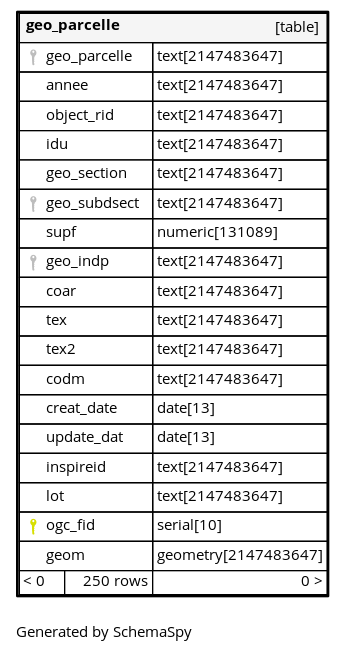
Columns
| Column | Type | Size | Nulls | Auto | Default | Children | Parents | Comments | ||
|---|---|---|---|---|---|---|---|---|---|---|
| geo_parcelle | text | 2147483647 | null |
|
|
Identifiant |
||||
| annee | text | 2147483647 | null |
|
|
Année |
||||
| object_rid | text | 2147483647 | √ | null |
|
|
Numéro d’objet |
|||
| idu | text | 2147483647 | √ | null |
|
|
Identifiant |
|||
| geo_section | text | 2147483647 | null |
|
|
Section |
||||
| geo_subdsect | text | 2147483647 | √ | null |
|
|
||||
| supf | numeric | 131089 | √ | null |
|
|
Contenance MAJIC |
|||
| geo_indp | text | 2147483647 | √ | null |
|
|
Figuration de la parcelle au plan |
|||
| coar | text | 2147483647 | √ | null |
|
|
Code arpentage |
|||
| tex | text | 2147483647 | √ | null |
|
|
Numéro parcellaire |
|||
| tex2 | text | 2147483647 | √ | null |
|
|
tex2 - non documenté |
|||
| codm | text | 2147483647 | √ | null |
|
|
codm - non documenté |
|||
| creat_date | date | 13 | √ | null |
|
|
Date de création |
|||
| update_dat | date | 13 | √ | null |
|
|
Date de dernière modification |
|||
| inspireid | text | 2147483647 | √ | null |
|
|
||||
| lot | text | 2147483647 | √ | null |
|
|
||||
| ogc_fid | serial | 10 | √ | nextval('cadastre.geo_parcelle_ogc_fid_seq'::regclass) |
|
|
||||
| geom | geometry | 2147483647 | √ | null |
|
|
Indexes
| Constraint Name | Type | Sort | Column(s) |
|---|---|---|---|
| geo_parcelle_pk | Primary key | Asc | ogc_fid |
| geo_parcelle_centroide_geom_idx | Performance | ||
| geo_parcelle_geo_parcelle | Performance | Asc | geo_parcelle |
| geo_parcelle_geo_section_idx | Performance | Asc | geo_section |
| geo_parcelle_geom_idx | Performance | Asc | geom |
| geo_parcelle_idu_idx | Performance | Asc | idu |
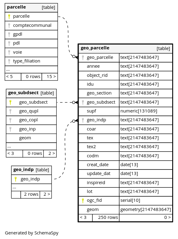
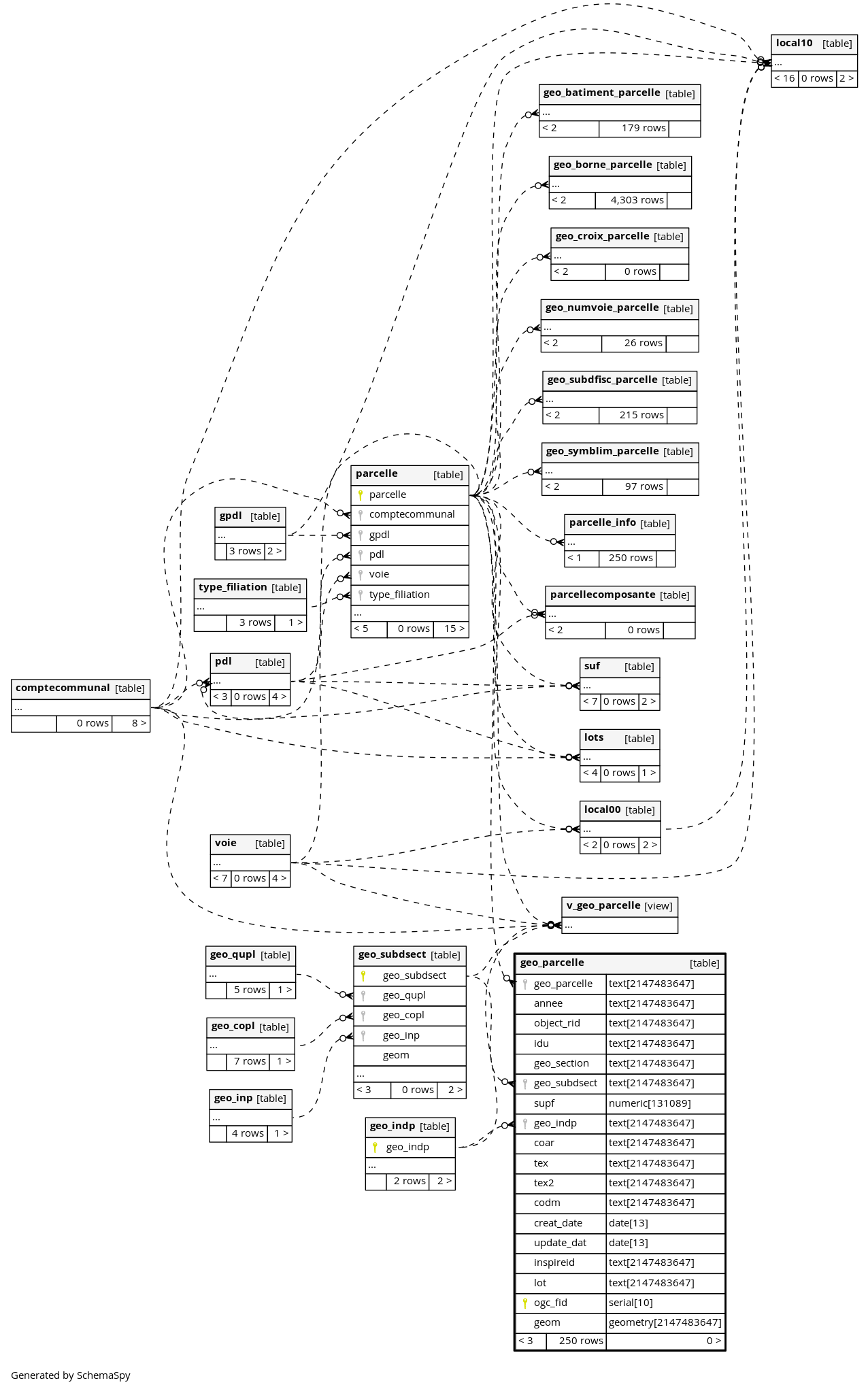
Relationships
Close relationships within degrees of separation